A forked, mass-start event with SI-timing. Estimated winning time around 35 to 40 minutes. Beginner and intermediate courses are individual start. A shorter advanced course individual start option is also available. This is not a Canada Cup certified event, but is some high quality orienteering Fun!
Start List
No start lists will be published for the event, as this an open Start window, or else a Mass Start depending on the course – see below.
Schedule
- Open Start Window: 13:45-14:45
- Mass Start: 15:00
- Time Limit: 2 hours
- Course Close: 17:15
Parking
There are 2 parking areas:
- Parking 1: Kelowna Nordic Summit parking lot at the Event Arena.
- Parking 2: Bottom of Kallis FSR at intersection with Highway 33.
Please carpool as much as possible to this event to ease the pressure on the relatively small parking areas.
Toilets
- Parking 1 / Event Arena
- Several port-a-potties and 1 outhouse
- Please use the port-a-potties and not the outhouse
- Parking 2
- 1 port-a-potty and 1 outhouse
- Please use the port-a-potty and not the outhouse
Route to Start
- From Parking 1 / Event Arena
- Go to Parking 2: 900 m distance and 40 m descent
- From Parking 2:
- 1100 m distance and 60 m climb
- Note: the finish is at the Event Arena / Parking 1
| Course | Distance (km) | Climb (m) | Controls | Classes | Map Scale | Technical Difficulty |
|---|---|---|---|---|---|---|
| Open Start Beginner | 1.8 | 35 | 9 | Open (Any) | 1:7500 | Beginner (TD2) |
| Open Start Intermediate | 2.2 | 60 | 10 | Open (Any) | 1:7500 | Intermediate (TD3) |
| Open Start Advanced Short | 2.8 | 125 | 12 | Open (Any) | 1:7500 | Expert (TD5) |
| Mass Start Advanced | 4.9 | 230 | 22 | Open (Any) | 1:10000 | Expert (TD5) |
Organizing Team
- Course Planner: David Bakker (Sage)
- Controller: Kevin Matrosovs (Sage)
Map: Thunder Mountain North
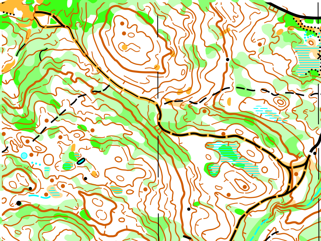
Hillier terrain with larger contour features and smaller pockets of contour detail. Very similar vegetation to Kelowna Nordic Core, but with sections of very dense forest that drive route choice decisions in otherwise highly runnable, white forest with no deadfall. This terrain features scattered rock features and marshes, with a low to medium density trail network.
- Mapper: Bryan Chubb
- Year Mapped: 2021-2022
- Standard: ISOM2017-2
- Print Scale: 1:10,000 for most categories and 1:7500 for select categories
- 2020 Computer Generated Map of Part of the Area: Available Here for Fairness Purposes